Haku
Viitteet 1-10 / 15

A new map of the Baltick & c.: shewing all the dominions about it with ye great or post roads and principal cross-roads
([London]: [Herman Moll], ca. 1720, 1720)

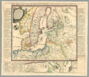
Tabula Geographica Regnorum Sveciae Daniae et Norwegiae : ad emendatiora Exempla adhuc edita jussu Acad. Reg. scient. et litter. eleg. Boruss. descripta
([Berolini]: [Ex officina Michaelis], 1753, 1753)

A new map of Denmark and Sweden: according to ye newest and most exact observations
([London]: printed for H. Moll over against Devereux Court without Temple Bar in the Strand Iohn Bowles at the Black Horse in Cornhill, Thomas Bowles print & mapseller next to the Chapter House in St. Pauls Church yard and by Philip Overton map & printseller near S. Dunstans Church Fleetstreet, 1712, 1712)

Les Royaumes de Suede et de Norwege, divisés en leurs Provinces ou Gouvernemens, par le S. Robert de Vaugondy Geog. ord. du Roi, de S.M. Pol. Duc. de Lorraine et de Bar, et de l'Academie Rle. des Sciences et Belles-Lettres de Nancy
([Paris]: [Robert de Vaugondy], avec priviége 1756, 1756)


Sweden and Norway: according to the newest observations
([London]: [Herman Moll], 1711?, 1711)

Nova mappa geographica Sueciae ac Gothiae regna ut et Finlandiae ducatum ac Lapponiam, cum provinciis minoribus, ob oculos ponens, cura et sumtibus Tobiae Conradi Lotter, chalcogr et geogr: Augustae Vindel.
(Augustae Vindel. [Augsburg] : Tobias Conradus Lotter, [vuosien 1756 ja 1777 välillä], 1756)

Baltia, quae et Scandia, Finningia, Cimbrica Chersonesu & c.
([Paris]: [Jean le Clere], 1703, 1703)

Sueciæ, Lapponiæ et Norvegicæ: nova tabula, multis locis aucta, in provincias divisa et correcta, per F. de Witt cum privilegio
(Amstelodami: ex officina I. Cóvens et C. Mortier, vuosien 1721 ja 1778 välillä, 1721)